Integrated drought management
![]() This is an NSF-funded project in collaboration with Peter Debaere and Brian Richter at UVA, Mesfin Mekonnen at the University of Alabama, and Paul Block at the University of Wisconsin, Madison.
This is an NSF-funded project in collaboration with Peter Debaere and Brian Richter at UVA, Mesfin Mekonnen at the University of Alabama, and Paul Block at the University of Wisconsin, Madison.

Colorado River Basin: Droughts are among the most severe natural disasters in the U.S., challenging farmers and urban communities reliant on water supply and freshwater ecosystems threatened by low streamflow. Attempts to reduce multi-sectoral drought impacts are facilitated by human institutions governing water allocation and demand, and critical reservoir infrastructure designed to modulate supply. However, these two avenues of water management are typically treated separately, preventing drought management systems from achieving their full potential. The goal of this project is to evaluate the potential gains of better coordinated, forecast-informed drought management of water systems and their institutional and physical infrastructure to simultaneously reduce community impacts of drought and facilitate sustainable economic growth. The project focuses on the drought-prone Upper Colorado River Basin, where decreased snowmelt runoff resulting from climate warming and urban growth are rapidly intensifying water scarcity risks.
Coastal flood adaptation
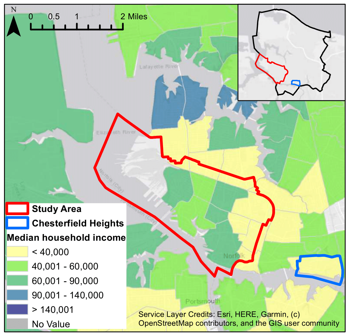
Norfolk, VA: Urban coastal floods affect millions of people worldwide with impacts ranging from frequent and minor to infrequent and catastrophic. Characterizing the risk of these floods is complex due to their compound, non-independent drivers and nonstationarities. Consequently, choosing between flood mitigation infrastructure alternatives is both urgent and challenging. This project centers on developing optimization techniques to discover adaptive flood mitigation policies that are robust to climate change in Norfolk, VA. Objectives include equitably minimizing the human and economic cost of flooding ranging in severity from nuisance to catastrophic. The flood mitigation infrastructure measures being considered include nature-based solutions such as salt marsh restoration and oyster sills, green infrastructure such as best management practices for stormwater control, gray infrastructure such as redesigned storm sewers and sea walls, and policy measures like coastal retreat and subsidies to fortify buildings against flooding.
Green infrastructure planning
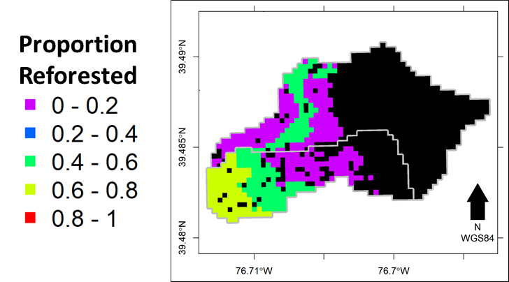
Baltimore Ecosystem Study: Urban land expansion is expected for our changing world, which unmitigated will result in increased flooding and nutrient exports that harm the wellbeing of coupled human-natural systems worldwide. Increasing canopy cover over urban surfaces with green infrastructure (GI) is one strategy to reduce stormwater volumes and excess nutrient exports. This project focuses on designing GI portfolios to balance the benefits of flood flow and nutrient reduction with the costs of implementing GI and the chance to exacerbate droughts via reduction in recharge that supplies low flows. A major focus is ensuring the designs are robust to uncertainty in future climate conditions and the parameterization of the hydrologic model.
Socio-ecological systems modeling of hydropower systems
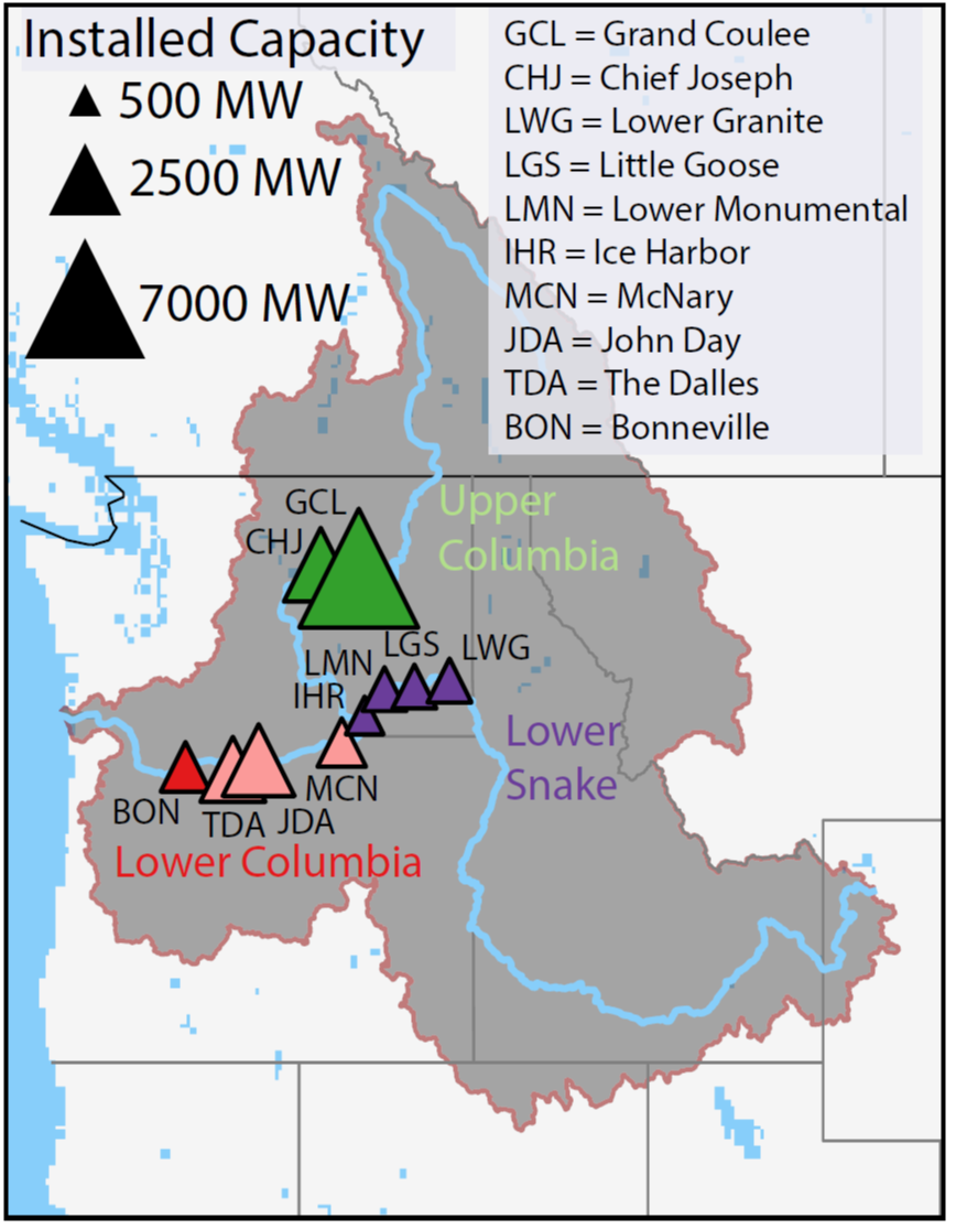 Columbia River Basin: By 2050, the U.S. Energy Information Administration (EIA) projects renewables will surpass natural gas as the predominant source of U.S. electric power and that their portion of U.S. electric generation will double from 21% to 42% [US EIA, 2021]. While this decarbonization will enable overdue reductions in carbon emissions, it will also make our energy supply more dependent on the vagaries of the weather, whose variability itself is expected to increase due to climate change. This will require managing variability over multiple time scales and for conflicting objectives. For example, hydropower management has to consider not only energy demands, but also operational consequences on water supply, flood risk, and environmental flows. The goal of this project is to develop information-theoretic methods for conditioning the operations of hydropower dams to balance conflicting objectives over multiple time scales as the grid decarbonizes. The project focuses on the Columbia River Basin, where hydropower dams and their reservoirs provide 50-65% of the region’s electric power, irrigation for 7.3 million acres of land, and 55.3 million acre-feet of storage for flood protection, but threaten the viability of salmon migration.
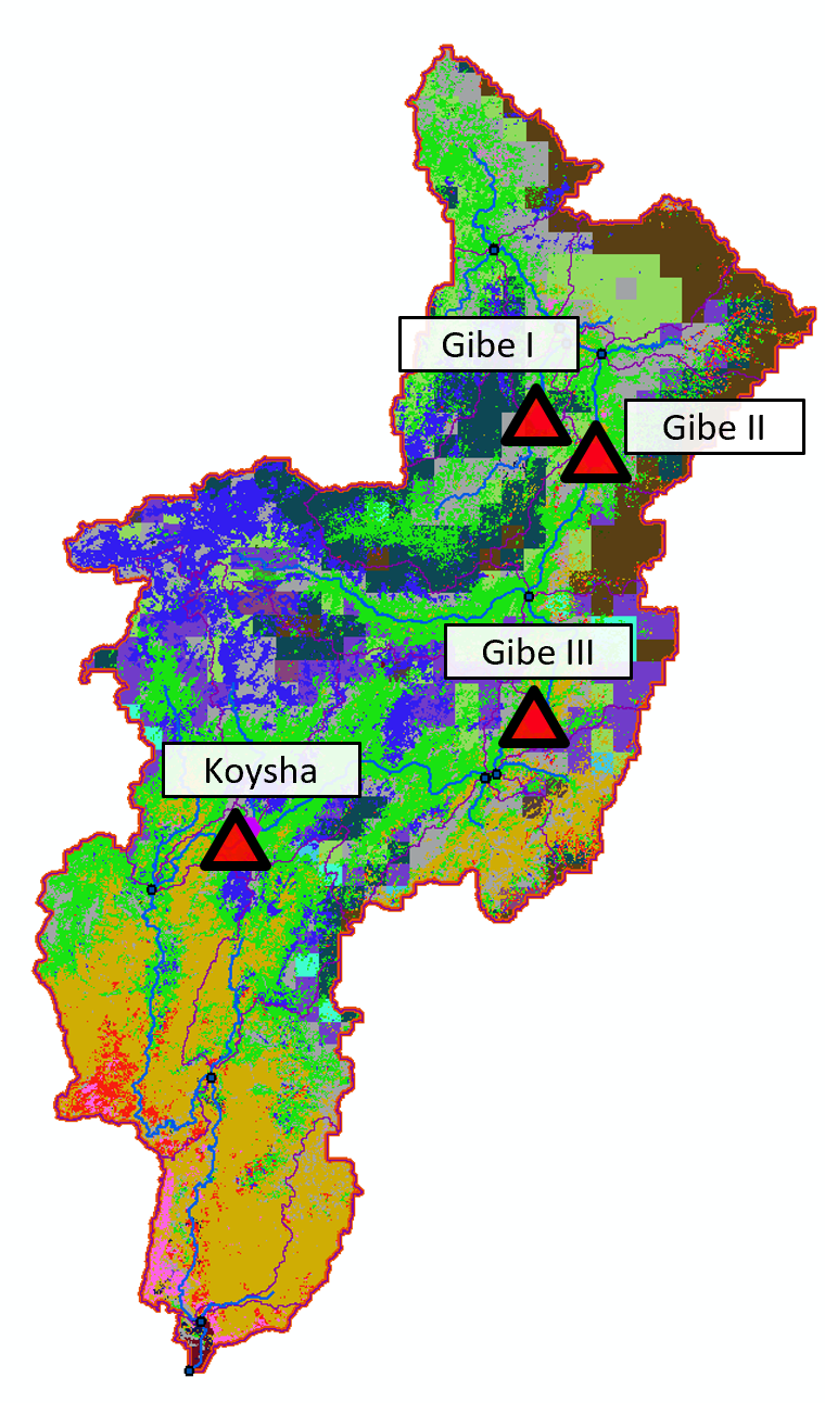 Omo River Basin, Ethiopia: Economic development, population growth, and climate change have triggered an increase in global dam construction as a source of domestic water supply, irrigation, and renewable energy. The economic benefits associated with dams have historically been the primary drivers in decisions about how to operate reservoirs. However, this approach often benefits private companies and governments while placing the costs of hydropower development on local communities and the environment, resulting in steep social and ecological consequences. A useful tool for analyzing such agroecological tradeoffs is the Soil and Water Assessment Tool (SWAT), which can model irrigation, fertilizer application, and reservoir operations, although options for simulating reservoirs remain fairly limited. This project advances the representation of reservoir operations in the Soil and Water Assessment Tool (SWAT) to facilitate the design of robust and adaptive reservoir management that can reduce socioecological conflicts under climate change relative to uncontrolled conditions. The project focuses on the Omo River basin of Ethiopia, where controversial dam construction is creating opportunities for hydropower and irrigation but has proven detrimental to indigenous people and aquatic wildlife dependent on the natural flow regime.
